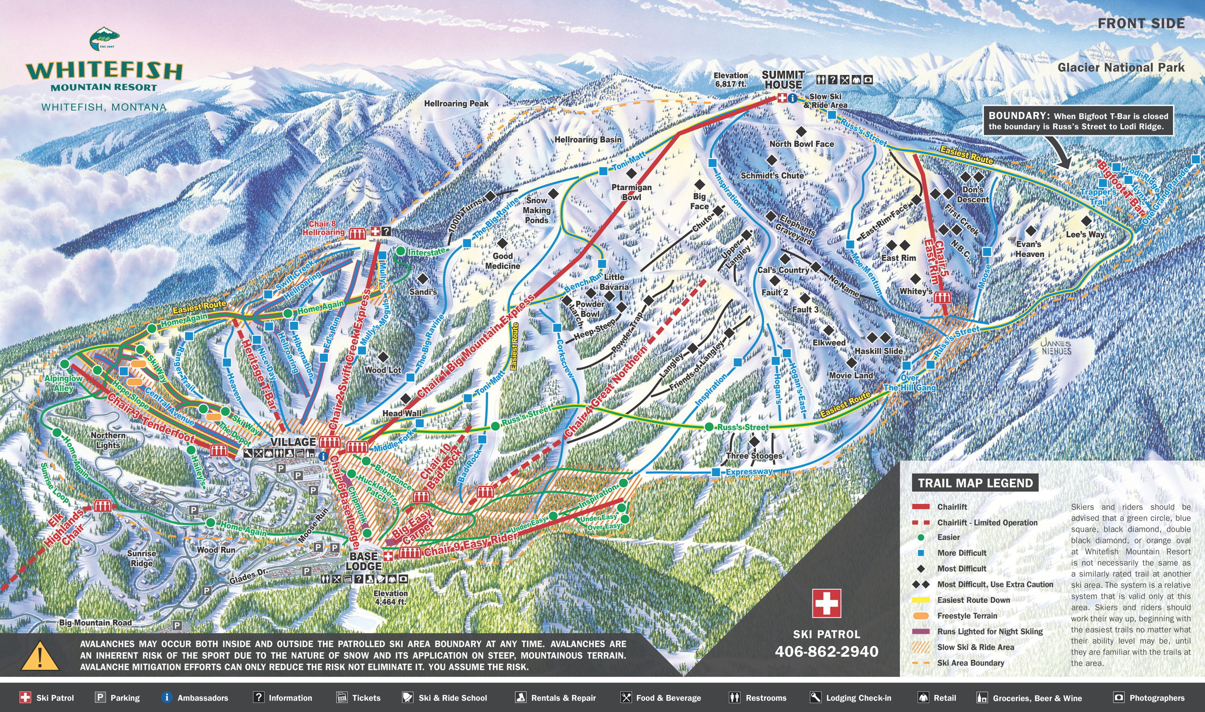
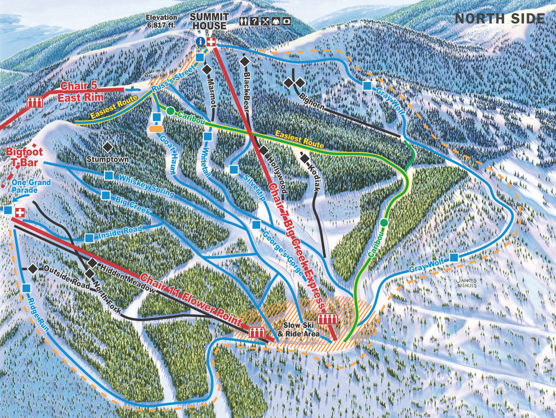
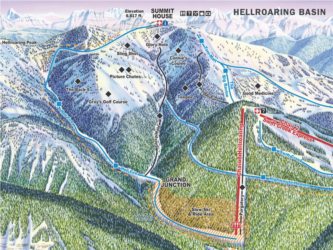
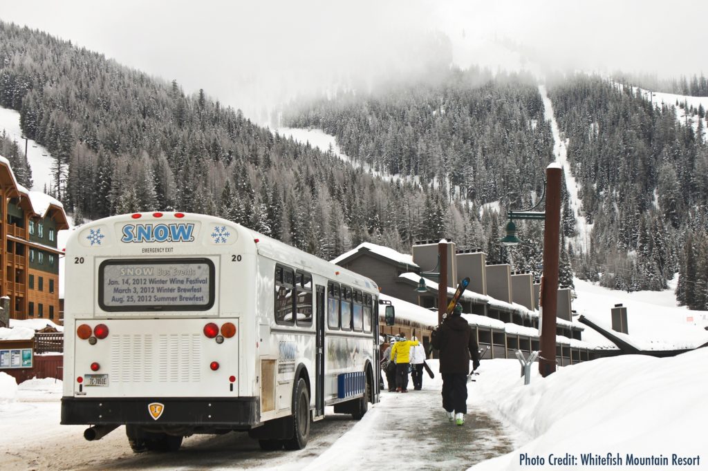
Whitefish Mountain is Steep! Deep! Amazing! See what it is all about. You can see trailmaps, webcams, stats and the SnowBus schedule. Trail Maps Front Side North Side Hellroaring Basin Uphill Front Side North Side Hellroaring Basin Uphill Whitefish Mountain Resort Stats Trails and Terrain 3,000 acres105 marked trailsVast amounts of bowl and tree skiingLongest Run: 3.3 miles (Hellfire)4 terrain parks and a skier/boardercross course Difficulty 12% Easier38% More Difficult43% Most Difficult7% Most Difficult – Use Extra Caution Snowfall and Temperatures Seasonal Snowfall: 300 inchesAverage high 32 degrees F/ 0 CAverage low 17 degrees F/ -8 C Elevation Summit elevation 6,817 ft./2,078 mBase elevation 4,464 ft./1,361 mVertical drop 2,353 ft./717 m Ride the free SNOWbus up to Whitefish Mountain Resort Village stop and walk a short distance to our shop!